Muhos-formation

The Muhos Formation, which is estimated to extend nearly a kilometer deep beneath the Earth's surface, is a significant geological feature. This ancient bedrock depression has had a wide-ranging impact on the natural conditions of the Oulujoki River Valley, shaping them into what they are today. The formation stretches from Muhos to the Gulf of Bothnia, reaching a width of up to approximately 25 kilometers and a length of about 80 kilometers.

Kalliota Lemmenpolulla. © Susanna Ukkola. Rokua Geopark

The Formation of the Muhos Formation

The history of the formation began nearly two billion years ago, when tectonic plates collided and a massive mountain range rose on an ancient continent. Over time, glaciers, wind, and flowing water wore down the mountains. Over hundreds of millions of years, the range was reduced to a nearly flat plain. As a result, rocks formed deep within the mountain range, such as granite, were eventually exposed at the Earth’s surface.

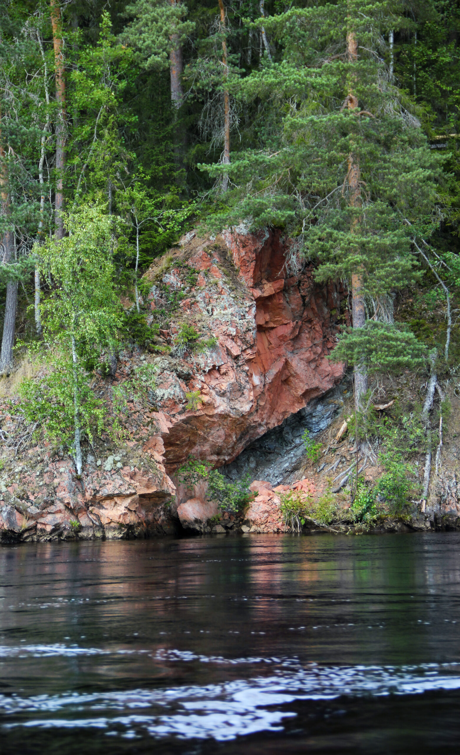
When tectonic stresses in the bedrock were released, the bedrock in the northwestern part of the Oulujoki River Valley began to subside. This so-called graben (rift valley) formed a sea bay that stretched from Muhos to Hailuoto. Rivers began to deposit gravel, sand, and clay into this basin. Over hundreds of millions of years, the depression filled up, and the layers of sediment hardened into rock—sometimes hundreds of meters thick—lying above the granite bedrock.

The graben was only discovered in the 1930s, during preparations for constructing hydropower plants on the Oulujoki. The only place where the hardened gravel of the Muhos Formation can be seen at the surface is along the Lemmenpolku nature trail in the village of Kiekki in Muhos. Due to an exposure of the formation’s lowest layer—known as conglomerate—the shoreline rock is protected under Finland’s nature conservation law. In the landscape, the edge of the formation appears as a distinct step where the granite bedrock plunges deep beneath the surface.

The Impact of the Muhos Formation on the Formation of Rokua Geopark

The Muhos Formation plays an important role in the entire origin story of Rokua Geopark. During the Ice Age, as glaciers ground down soft sandstone, meltwater carried vast amounts of sand from the Muhos Formation toward Rokua. The large quantity of sand in Rokua’s core ridge and the fine texture of Rokua’s sand can be explained by the Muhos Formation’s location along the meltwater flow route.

The Uniqueness of the Muhos Formation

One of the special features of the formation is that the temperature beneath the Earth’s crust at this location is higher than elsewhere in Northern Ostrobothnia or Northern Finland. This is due to the physical properties of the formation, which differ from the surrounding geology.

The sedimentary rocks filling the bedrock fractures form a thick layer of earth that insulates better than ordinary soil against heat rising from deep within the Earth toward the surface. Because the Muhos Formation is so deep, the temperature at its base is higher than in other areas. The carbon-neutral, medium-depth geothermal energy hidden beneath this insulating layer has been studied, for example, in Kirkkosaari in Muhos, but so far it has not been utilized.