2,900 – 2,600 million years ago
Ancient continent
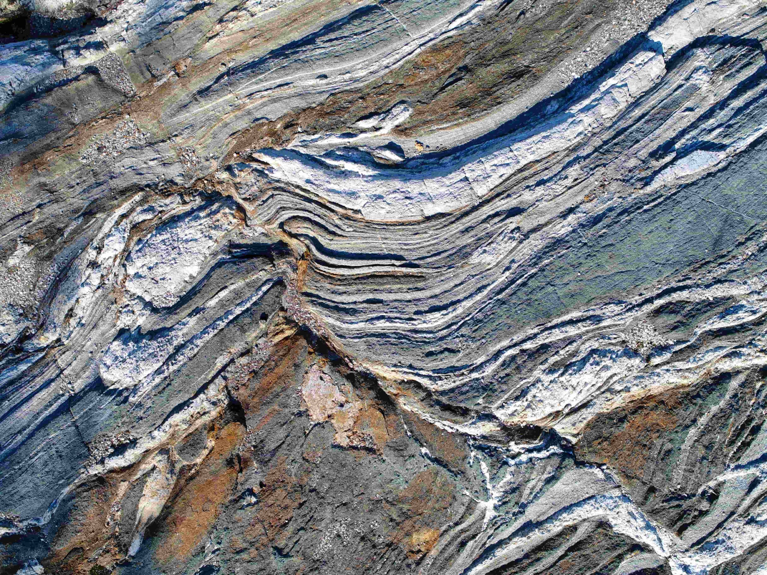
Kilonniemi gneiss outcrop
The gneisses of the Lake Oulujärvi belong to the oldest bedrock area of the EU. They have crystallised deep under an ancient mountain range. The mountains formed in a collision of Earth´s early continents. At that time the Earth´s atmosphere was lacking oxygen, and primitive cyanobacteria living in oceans were the most developed form of life. You can explore gneisses for example in Kilonniemi on Manamansalo island.
2,900 – 2,600 million years ago
2,300 – 2,060 million years ago
Splitting continent and an ocean
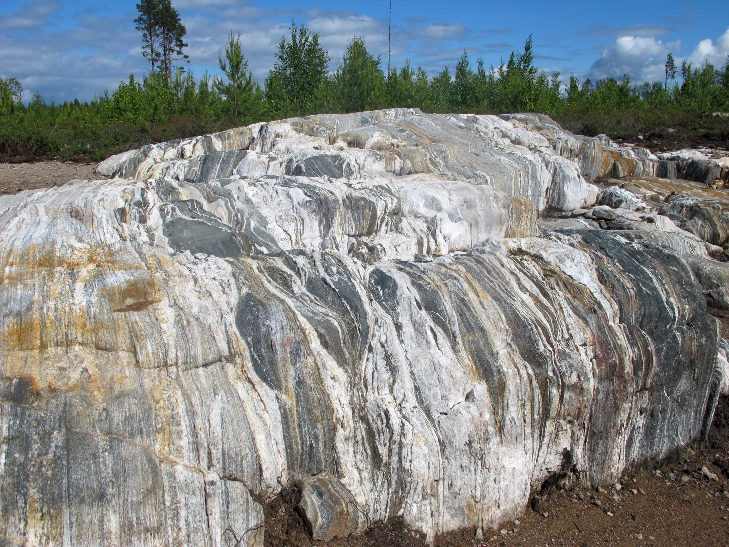
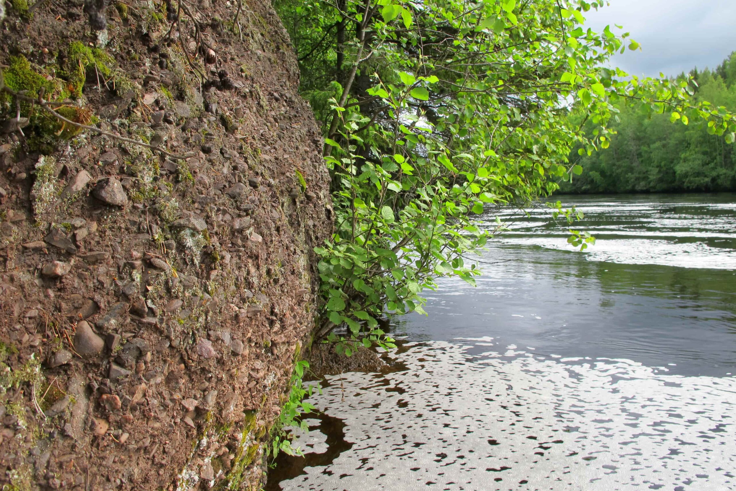
Luokkiniemi diabase vein
The ancient continent started to crack. Molten rock erupted from the cracks. Part of the magma crystallised in the cracks to diabase. You can recognise diabase as a dark-coloured vein in a bedrock outcrop, for example, in Luokkiniemi on Kuosto island. Gradually, the cracks opened to become valleys and sea bays, in which sand and gravel were deposited. The deposits crystallised to quartzites and conglomerates most easily found in rocky grounds in Utajärvi.
2,300 – 2,060 million years ago
1,960 – 1,790 million years ago
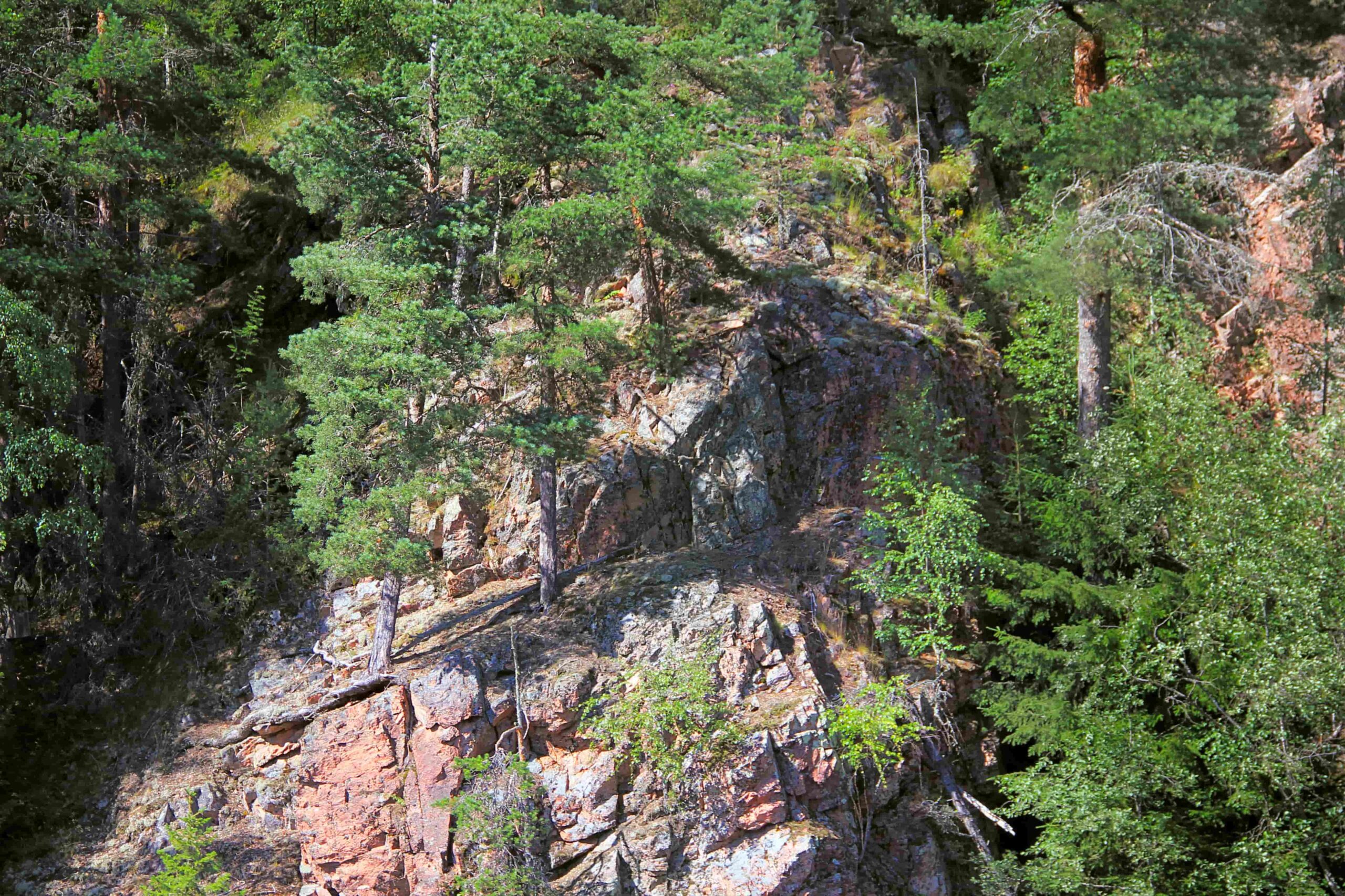
Mountain range
Granite cliffs of Pyhäkoski
The ocean was closed due to a collision of tectonic plates. As a result, a mountain range was formed. Deep under the mountains some of the marine sediments crystallised to schists, or melted and re-crystallised into granites. The Lemmenpolku Nature Trail by River Oulujoki features reddish granite cliffs crystallised from molten rock. The bedrock in Isterinkoski Rapids by River Poikajoki represents deformed marine sediments.
1,960 – 1,790 million years ago
1,300 – 600 million years ago
Shallow sea and a river delta
Kieksi conglomerate outcrop
In the Muhos region, a block of bedrock started to sink and became a shallow bay. At first, gravel, sand and silt were deposited in the deltas of ancient rivers discharging into the depression. As the sea deepened, clay was also deposited on its bottom. The deposits crystallised to sediment rocks of Muhos formation. You can see an outcrop of gravel stone in a cliff by River Oulujoki, close to Montta. Sediment rocks of Muhos formation contain fossils of primitive unicellular organisms.
1,300 – 600 million years ago
18,000 – 10,700 years ago
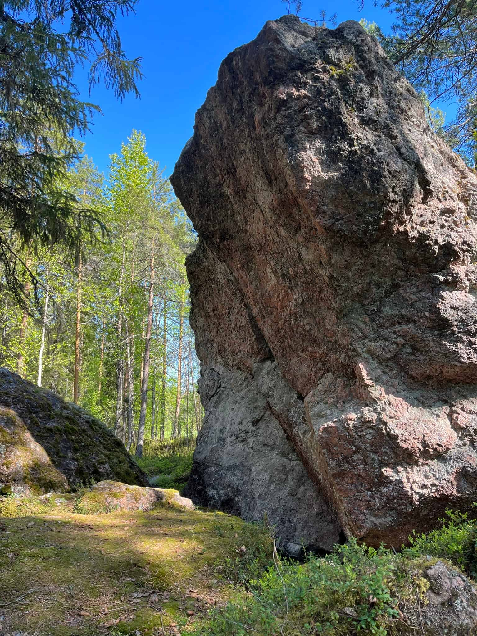
Continental ice sheet
Erratic boulder in Väätäjänniemi
The slowly moving ice sheet eroded the underlying rock forming rounded outcrops called roches moutonnées and their striations. The rock material detached from bedrock were deposited on the bottom and at the edge of the ice sheet into moraine landforms. The ice sheet also transported huge rocks called erratic boulders. The Väätäjänniemi erratic boulder in Vaala is about the size of a small detached house and weights several hundred thousand kilos. The erratic boulder consists of pegmatite granite crystallised deep under the ancient mountain range.
18,000 – 10,700 years ago
12,500 – 10,500 years ago
Meltwater streams
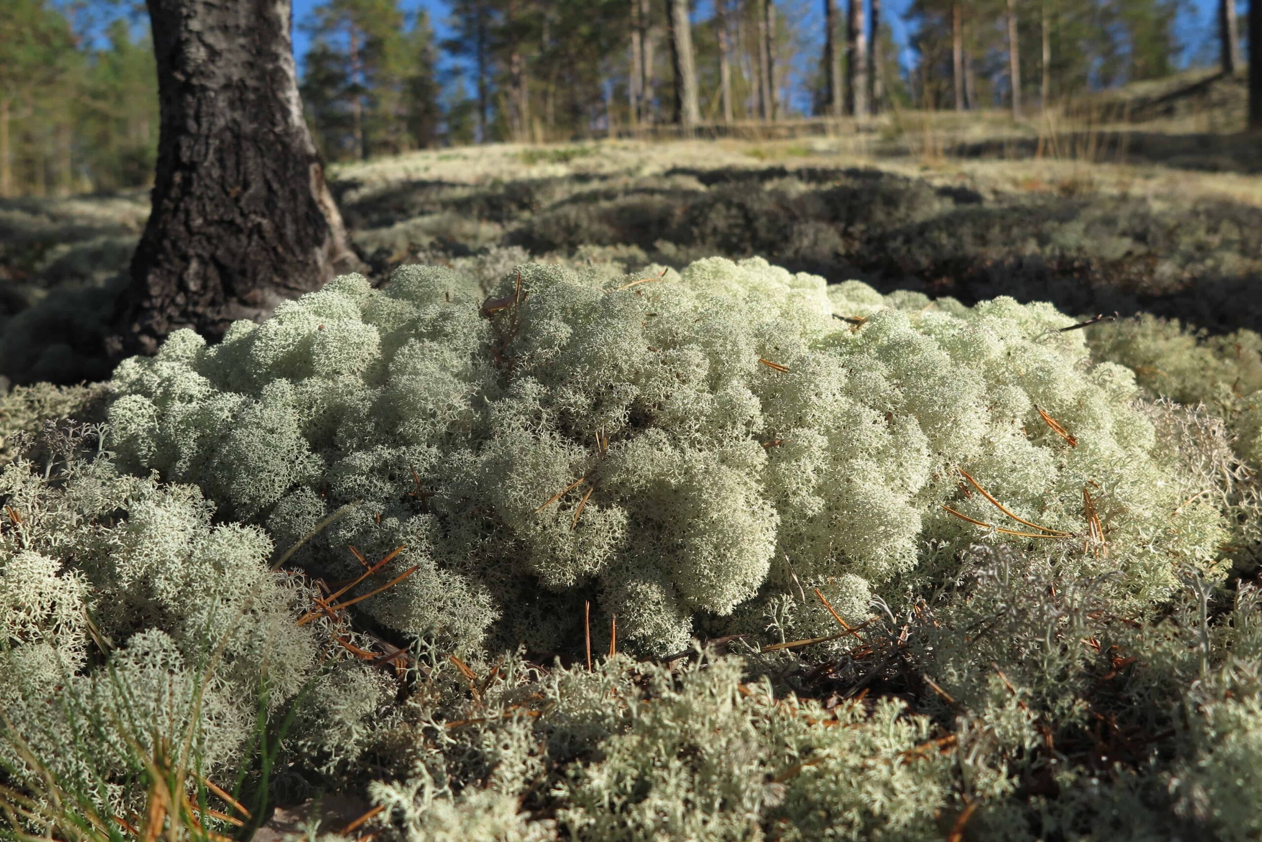
Rokua esker
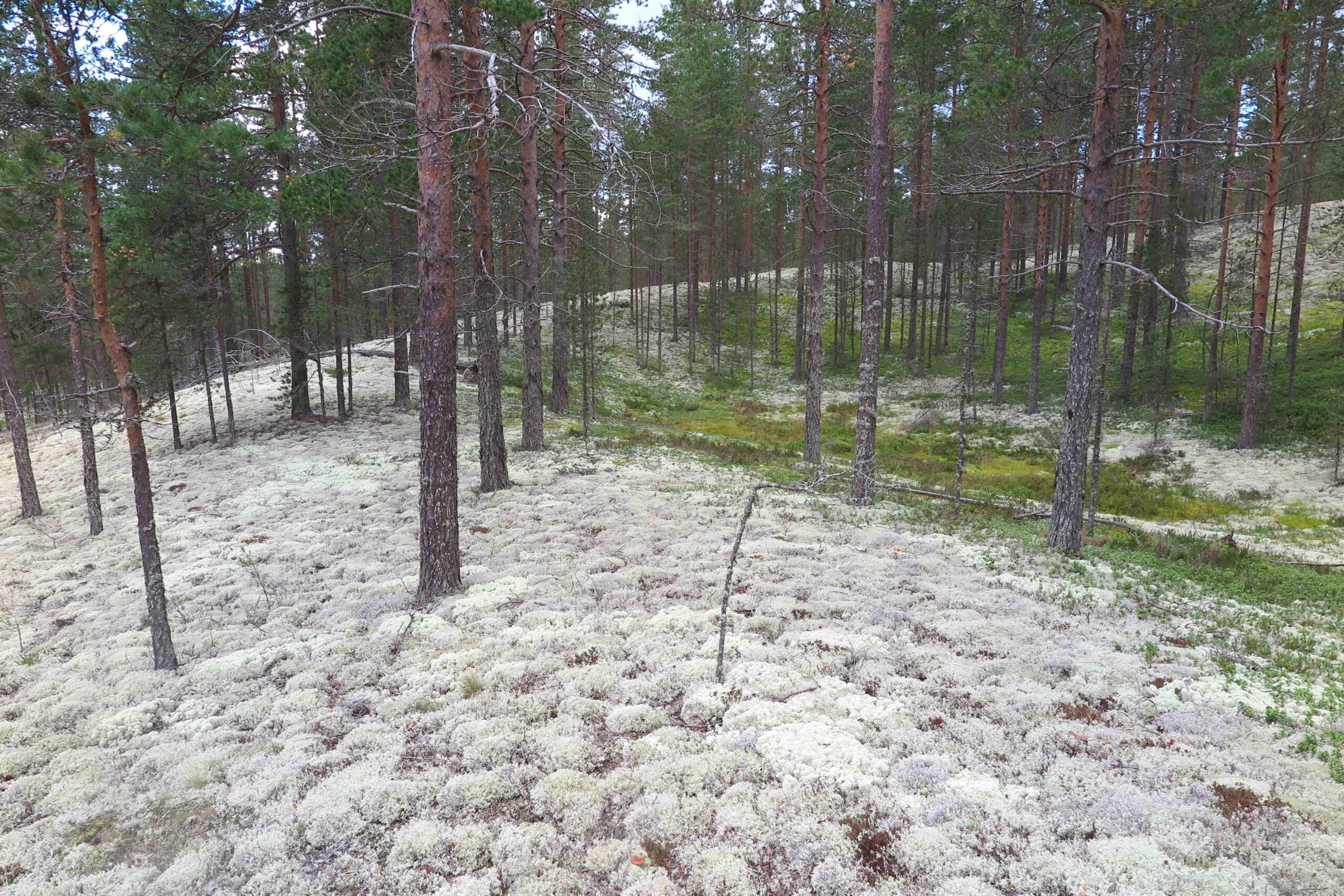
Rokua esker traverses the entire Rokua Geopark area. The esker consists of gravel and sand deposited by glacial meltwater. Gravel was deposited in ice tunnels where meltwater ran. At the edge of the ice sheet, meltwater burst out, and deposited sand into a delta. On Rokuanvaara Hill, the esker and delta deposits are 100 metres thick in places. The fin-grained sand of the deposits originates to the sediment rocks of Muhos formation. Typical vegetation of the sandy esker area are snow-white lichen heaths and pine forests.
12,500 – 10,500 years ago
10,500 – 9,500 years ago
Kettle holes
Syvyydenkaivo
As the esker was deposited, ice blocks were buried in the sand. As they melted due to climate warming, kettle holes were formed. Together, the esker and the kettle holes form a kame terrain, which is typical of the Manamansalo and Rokuanvaara Hill landscape, for example. The highest esker mound of Rokuanvaara Hill, the Pookivaara Hill, is bordered by several kettle holes. One of them, Syvyydenkaivo, is the deepest natural kettle hole in Finland. The slopes of the kettle holes offer a variety of habitats for several species.
10,500 – 9,500 years ago
10,400 – 1,500 years ago

Littoral formations
Hirsikangas ancient shore banks
After withdrawal of the ice, Rokua Geopark was initially covered by the Lake Ancylus. The ice sheet had depressed the earth's crust, so as the ice melted, the land began to lift up. The highest terrain points in Manamansalo and Rokuanvaara Hill were elevated above the water level in a couple of hundred years. Waves and wind deposited esker sand into beach ridges parallel to the shoreline. In the Hirskikangas area in Muhos, the kilometres-long ridges were formed on the coast of the Litorina Sea about 7,600 years ago. In many places there are mires between the beach ridges.
10,400 – 1,500 years ago
10,000 – 9,000 years ago
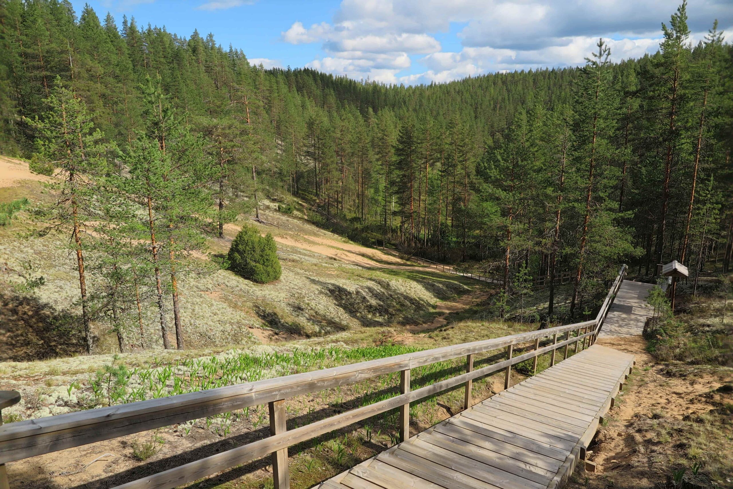
Dunes
Siirasvaarat area
Strong westerly winds deposited sand from the bare beaches to shore dunes. As the strong winds continued hundreds of years, the dunes progressed in the downwind direction, where they transformed into curved parabolic dunes. The development of the dunes ceased, when vegetation bound the sand. Rokuanvaara Hill is the largest dune field in Finland, including the highest dune in the country. In addition, there are dunes in Manamansalo island and Kurikkavaara area in Vaala. Dunes are the harshest habitats in Rokua, but also habitats for many rear species.
10,000 – 9,000 years ago
9,500 – 1,500 years ago
River valleys and channels
River Muhosjoki
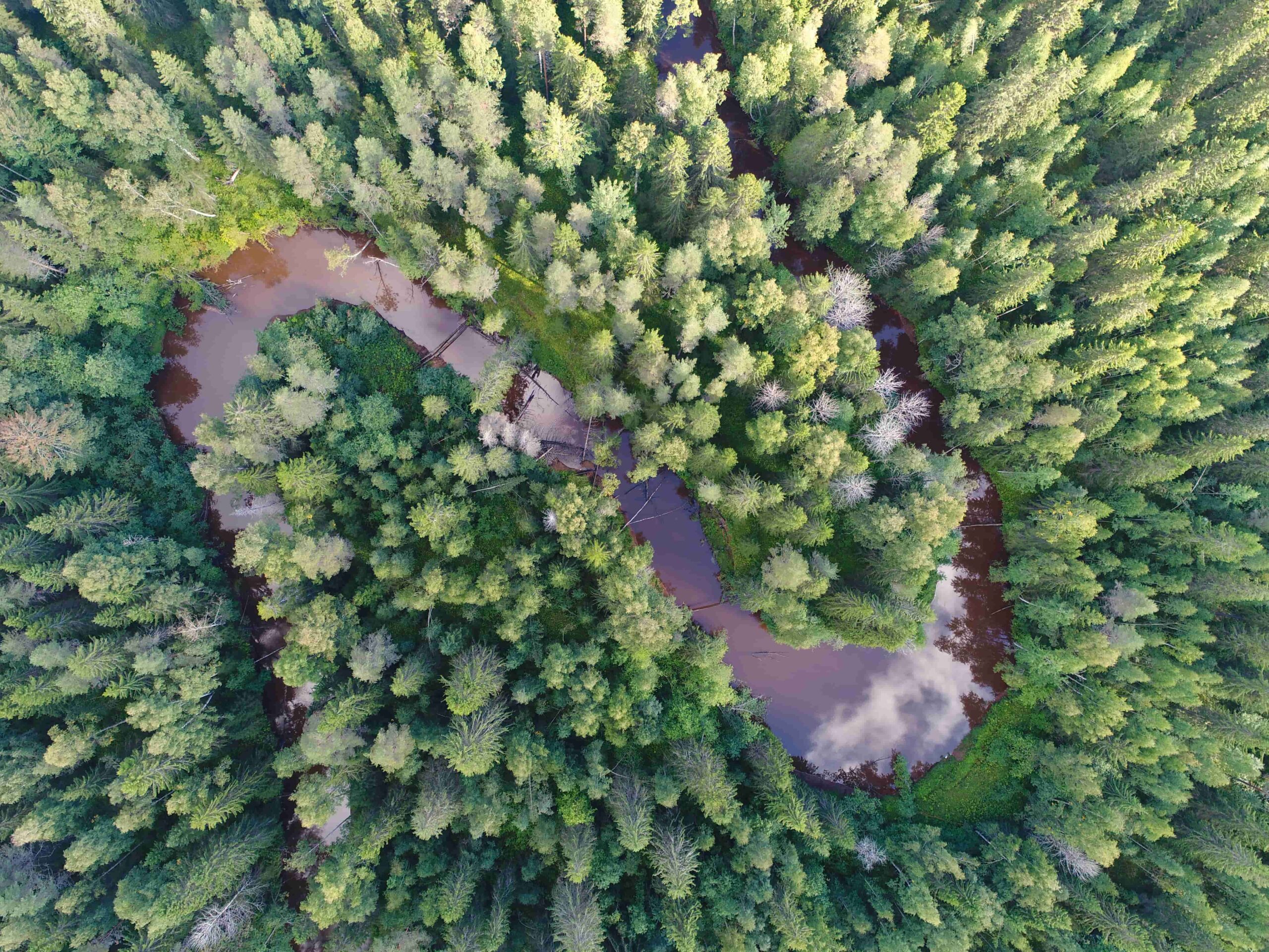
The River Oulujoki was born when the Vaalankurkku threshold rose above the surface of the Lake Ancylus about 9,500 years ago. Land uplift has moved the river mouth downstream, and water has found its way across pools and rocky outcrops. Tributaries and streams flowing into the river have carved steep-edged channels, ravines, into the sandy and clayey soils. On flat land, the channels have begun to meander. The deep and meandering channel of the River Muhosjoki has formed during the last 5,000 years. Lush groves grow by the deep channels, like at Liimanninkoski Rapids.
9,500 – 1,500 years ago
7,000 years ago
Early settlement
Säräisniemi comb ceramics
Lake Oulujärvi was cut off from Lake Ancylus 9,500 years ago. People were certainly wandering in the area at that time, although the earliest known traces of settlement are a thousand years younger. Fishing and waterways were important reasons to settle waterfronts. A lot of Säräisniemi 1 (Sär 1) ceramics and early comb ceramics, both of which are the oldest known types of ceramics in Finland, have been found in the vicinity of Lake Nimisjärvi. Bronze Age Säräisniemi 2 (Sär 2) ceramics are also known in the region. Several early settlements have remained below the surface of Lake Oulujärvi. Land uplift is faster in the Vaalankurkku region than in the eastern parts of the lake, which is why the beach has risen several meters after the cut-off.
7,000 years ago
6,000 years ago
Peat lands
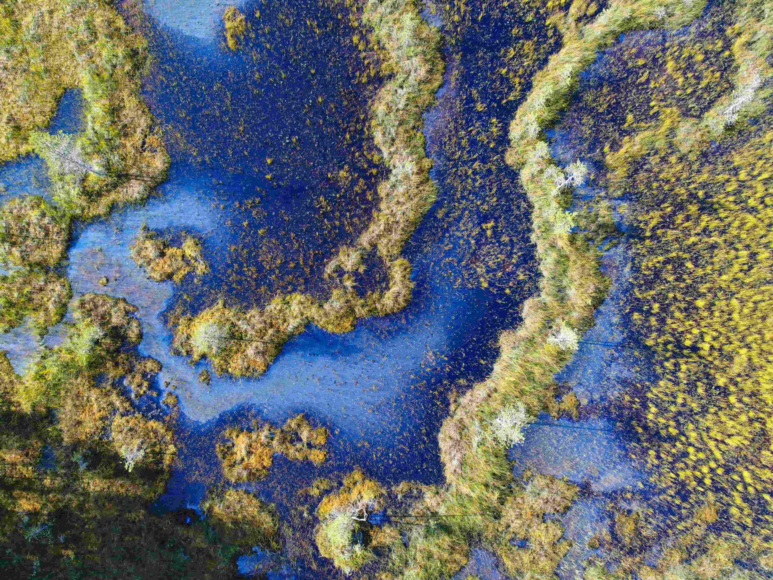
Kuvaja aapa mire
Peat began to form in wet terrain depressions as soon as they emerged from water. At beginning, peat formation was slow, but as the climate cooled and precipitation increased about 6,000 years ago, the rates of accumulation accelerated. In Rokua Geopark, mires have formed in kettle holes and water-retaining clayey and moraine terrains. The Kuvaja aapa mire is one of the largest mires in Rokua Geopark. Due to its valuable species, it has been protected. In the shores of Lake Oulujärvi, for example in Manamansalo, peat lands have remained below the rising water level and covered with sand eroded from shore bluffs. A Submerged mire can be recognized by soft and bubbling sandy bottom.
6,000 years ago
5,600 years ago
Settlement following the river mouth
Leppiniemi stone-age dwelling site
The stone-age inhabitants followed the moving river mouth. In Leppiniemi, an abundant stone-age settlement was developed on both sides of the River Oulujoki, because the river mouth remained in Pyhäkoski Rapids for a long time. The river mouth was a favorable place to live. There were good deer-hunting and berry-picking lands nearby. Fish and seals were sought from the river and the sea. The watersheds were also important itineraries used for connections to the east to Viena Karelia and to the west to the Scandinavian countries. Lots of stone-age dwelling sites can be recognized by pits in ground in Leppiniemi even today.
5,600 years ago
from 18th to 20th centuries
Peasant culture
Lamminaho Farm
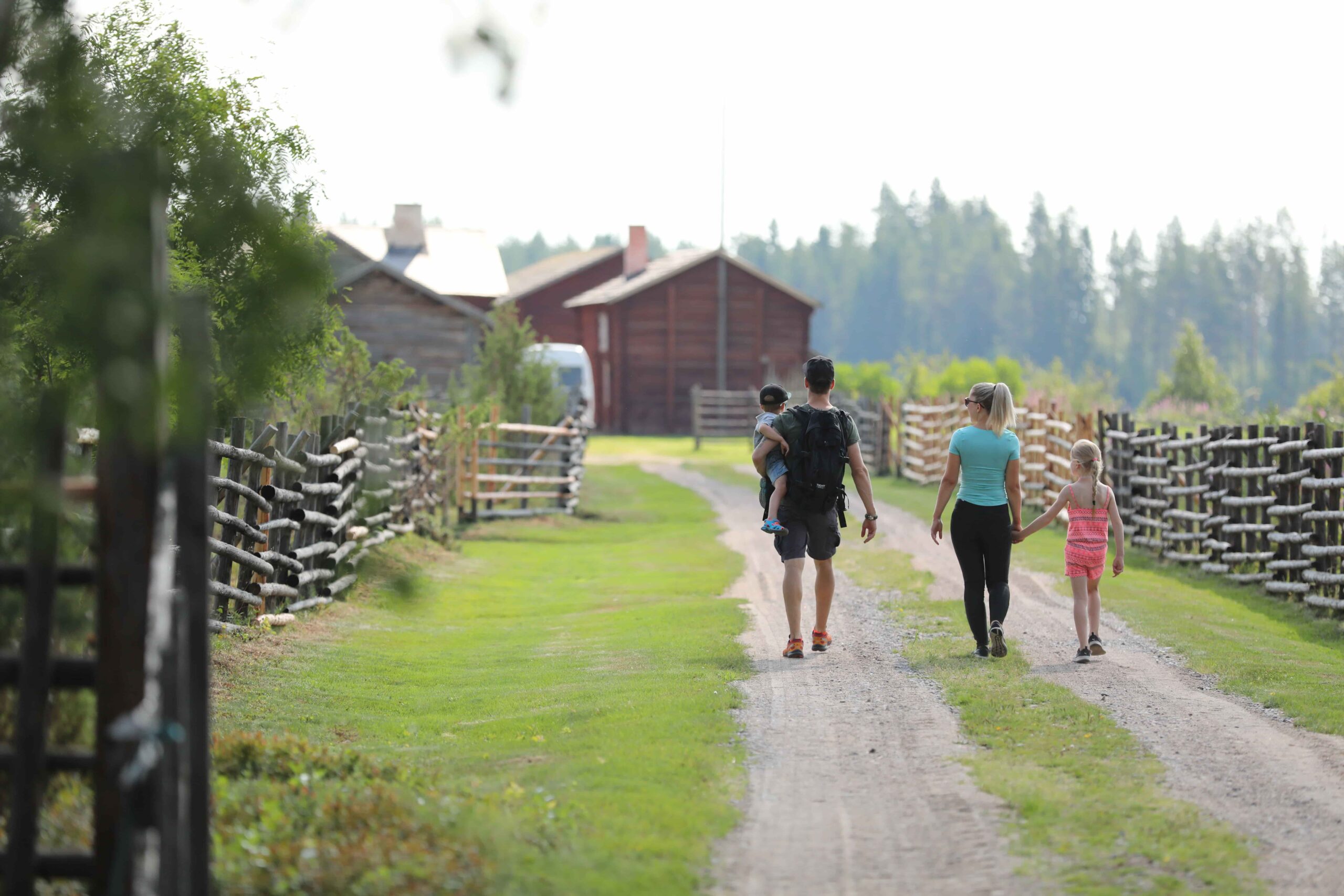
From the Stone Age to the Middle Ages, a dynamic hunting culture was practiced in the River Oulujoki Valley and Lake Oulujärvi areas. A Permanent settlement became more common in the 16th century. Persecutions and wars reduced the settlement, but there are still buildings by the river dating back to the 17th century. Many folk tales from the region have been recorded in the national epoch Kalevala. Lamminaho Farm in Vaala is an exceptionally well-preserved example of the peasant culture. In the farm you can admire buildings and objects from the 18th century. The main livelihoods were agriculture, rapid shooting, fishing and tar production. The farm belonged to the same family for almost 200 years. Today, it serves as a museum farm protected by the National Board of Antiquities. You can explore the peasant culture also in the local museums.
from 18th to 20th centuries
1634 – 1781 construction time
Old wooden churches
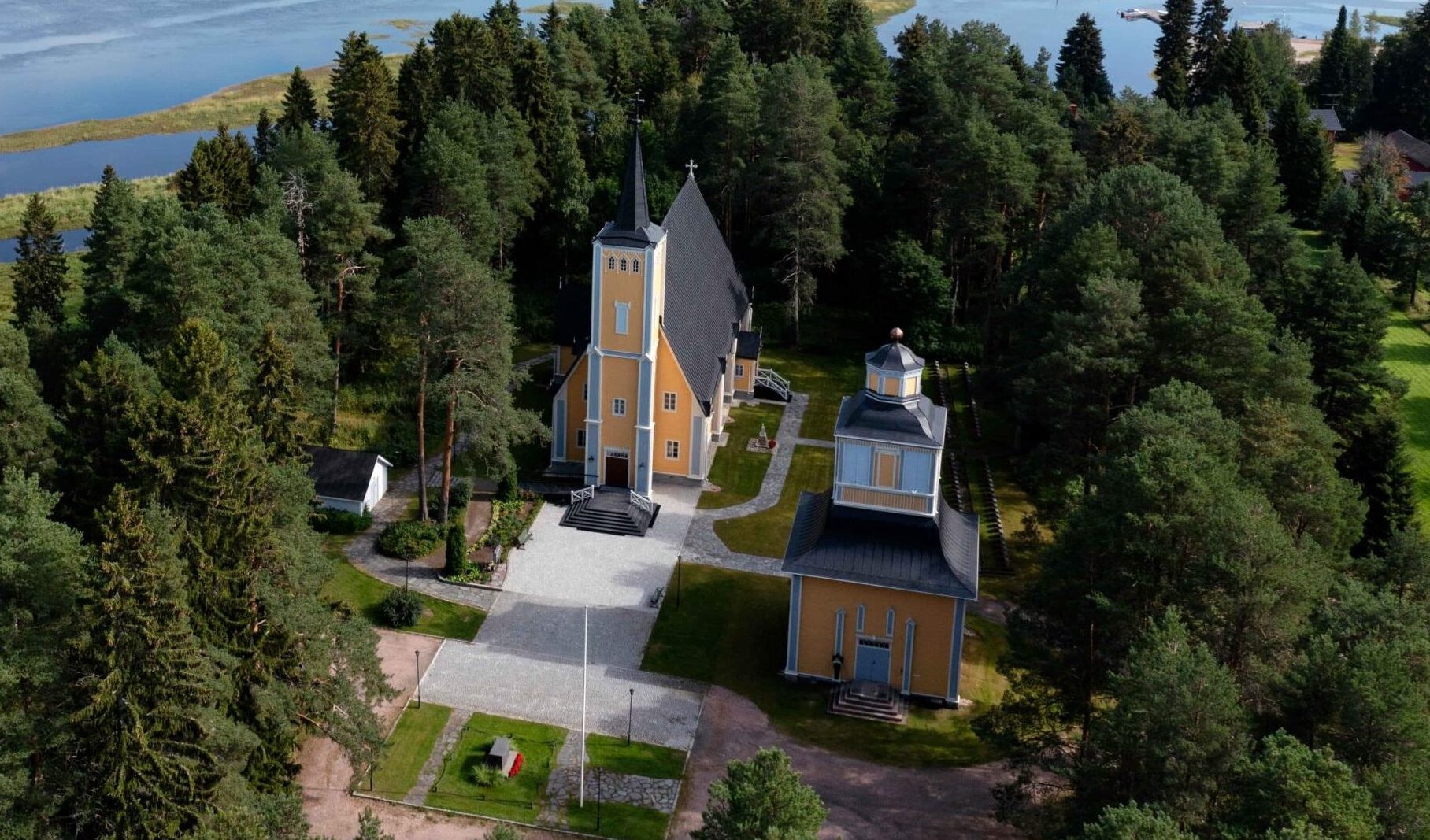
Muhos, Utajärvi and Säräisniemi.
The old wooden churches in Rokua Geopark represent traditional timber building skills. The Muhos Church (1634) is the oldest wooden church in Finland still in year-round use. The church features skilled paintings, wooden sculptures and furniture from the 17th and 18th centuries. Utajärvi Church (1762) represents Neo-Gothic style. The church is surrounded by a magnificent pine forest. Muhos and Utajärvi churches are so-called block pillar churches. Only twelve such churches with wooden structures are known in the world. Säräisniemi Church (1781) is a beautiful cruciform church. The bell tower still has the original bell from 1785. The stone footing of the church is made of folded gneiss quarried from the local Pirunkalliot bedrock outcrop.
1634 – 1781 construction time
Until the 1940´s
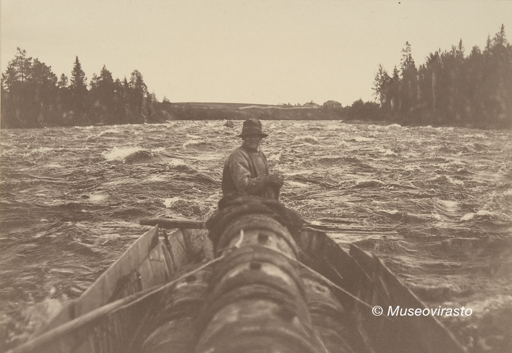
The free River Oulujoki
Fishing, tar trade and rapid shooting
The River Oulujoki has been an important itinerary and trade route since the Stone Age. During the golden age of the tar trade in the 19th century, up to 30,000 barrels of Kainuu tar were rowed into the city of Oulu annually. The rapids of the river attracted tourists from abroad, and the heads of state also went to try rafting. Wealthy “salmon lords”, especially from England, came to the river to catch salmons. The River Oulujoki was known for salmon in the Swedish court as early as the 16th century, and it is said that the bells of Muhos Church played “Salmon bread, salmon bread”. The Leppiniemi hanging bridge and tourist lodge (1934) opened up views of the free-flowing Pyhäkoski, where salmon dams and skilfully shooting boats were visible. The wild foams of the river have plagued many folk tales with their giants.
Until the 1940´s
1941 – 1957 construction time
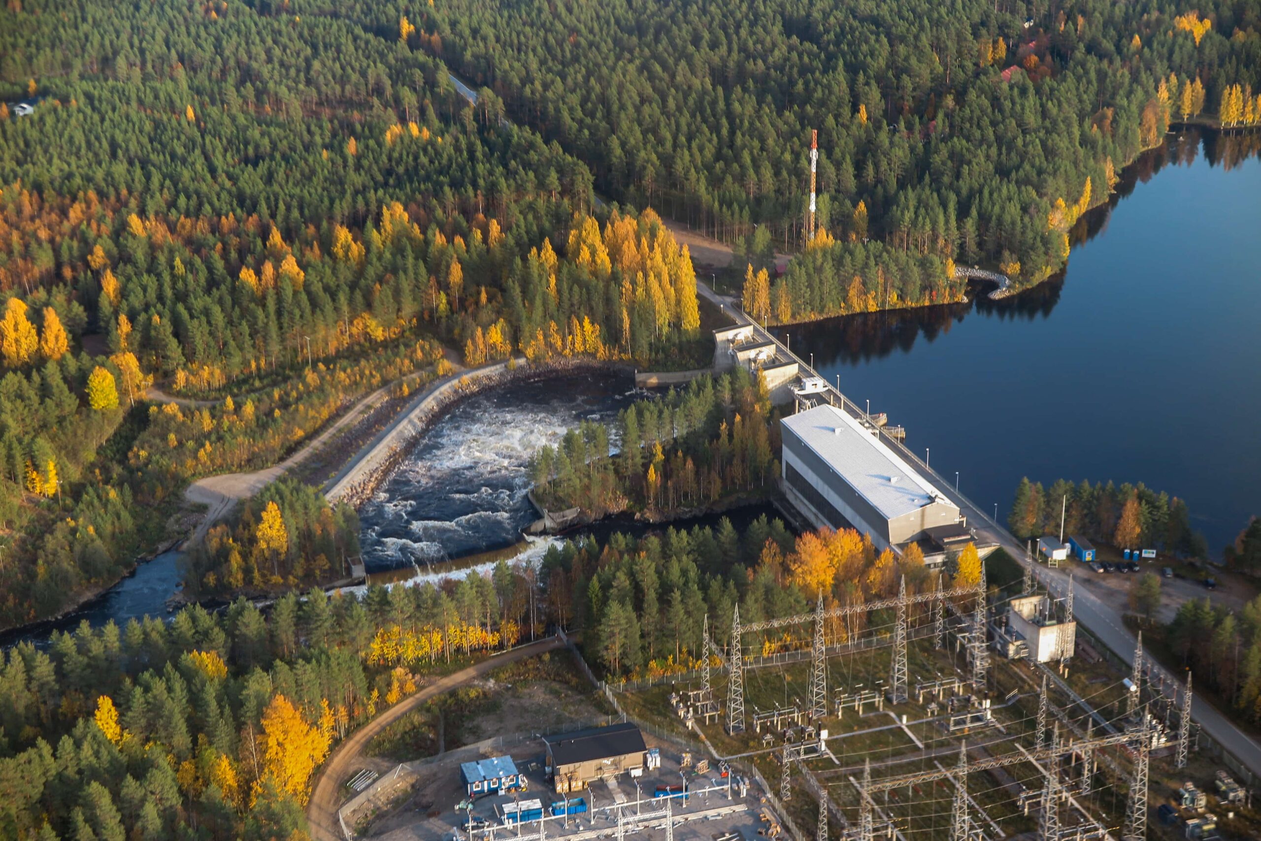
Hydropower plants of the River Oulujoki
The construction of the River Oulujoki was prepared even before the Second World War. In the peace treaty of the Continuation War, Finland lost a third of its hydropower. At the same time, the need for electricity increased, which accelerated the construction of the River Oulujoki. The construction of the power plants and their residential areas was a huge work; for example, in the construction site of Pyhäkoski, the biggest of the power plants, there were 1,700 employees at the same time. By the end of the 1950s, power plants were completed in Jylhämä, Nuojua, Utanen, Ala-Utos, Pälli and Montta. The power plants and residential areas designed by architect Aarne Ervi are now nationally valuable cultural history sites.